
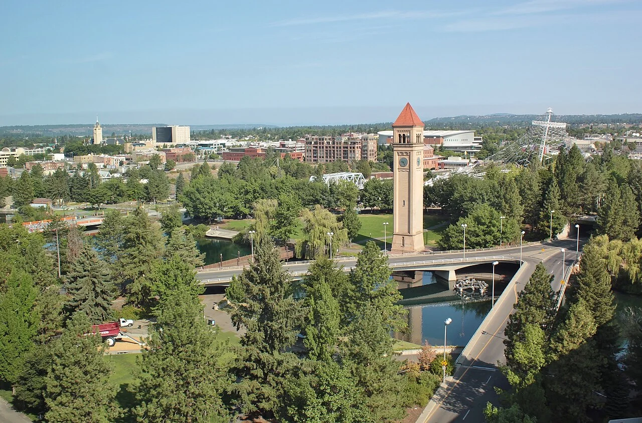
A night and two days in Spokane can begin by distinguishing the upper and lower falls, rather than treating them as two pictures of one stop. The Stork suggests connecting a downtown room and a West Main meal with Riverfront's different river views on the first day. Keep a quieter South Hill pond pause separate on the second morning, according to your actual onward connection. The result does not compress every park into one afternoon. Spokane River's distinct central sections and the changing scale of hillside neighbourhoods determine the plan, rather than a renamed Seattle itinerary. Historical photographs do not prove that every old viewpoint is accessible in the same way today.
Arrival and accommodation: downtown is not the same choice as South Hill
For one night, staying around downtown helps connect Riverfront with the West Main meal. Compare luggage acceptance, late check-in and the morning departure point alongside distance to the park. Accommodation towards South Hill can offer a different neighbourhood setting but requires a separate return after a central dinner. Do not let apparent closeness on a map hide gradients and transport arrangements. No named hotel is given a quietness guarantee, free-parking promise or perfect walking access. The decision should support your own arrival, bag needs, evening and purchased onward journey.
From the airport or another regional connection, use Spokane Transit's current route and alert pages. An old leaflet's Route 60 is not frozen into this guide as today's airport service; the current homepage shows Valley/Airport naming and changing service information. City Line is another option for central connections. Calculating a transfer before matching your actual arrival point, stop and room access would be misleading. No fixed fare or identical frequency across all days is supplied. After a long arrival, doing only the first central loop can be sufficient and leaves room for a seated meal instead of rushing between unrelated destinations.
Upper Falls: the first distinct river view
The selected Upper Spokane Falls photograph was taken from the Post Street bridge direction in February 2007. This upper section provides a specific first focus; it is not a crop of the lower-falls image. Keep the walk on currently accessible routes around Riverfront. Crossing fencing, work closures or a privately controlled viewpoint is not necessary to make the photo stop worthwhile. Looking at the moving water is a city pause, not an invitation to swim, approach by boat or undertake a supposedly risk-free activity at the edge.
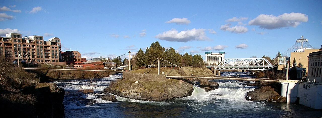

The city's current visitor information gives Riverfront Park daily hours of 06:00 to midnight. Those general park hours cannot be extended to every paid attraction, indoor section, boat or gondola. A short daylight interval that lets you understand the path can be more practical than attempting to complete a long list late at night. If a companion needs a rest, shorten the water pause and return to the centre. Snow or water volume visible in an old image does not document today's flow or season. The historical view is useful for identifying a river section, not predicting conditions on your date.
Lower Falls: a second look towards Monroe Street
The lower-falls photograph was taken from the Monroe Street Bridge direction in August 2008. A dam and electrical infrastructure also form part of its context. This second image shows another relationship between the river and the working city. After seeing the upper section, consider this as a separate brief observation according to your remaining time, rather than an obligatory extension of one oversized park tour. The purpose of the two viewpoints is to notice different water and urban relationships, not to inflate a list by counting the same scene repeatedly.
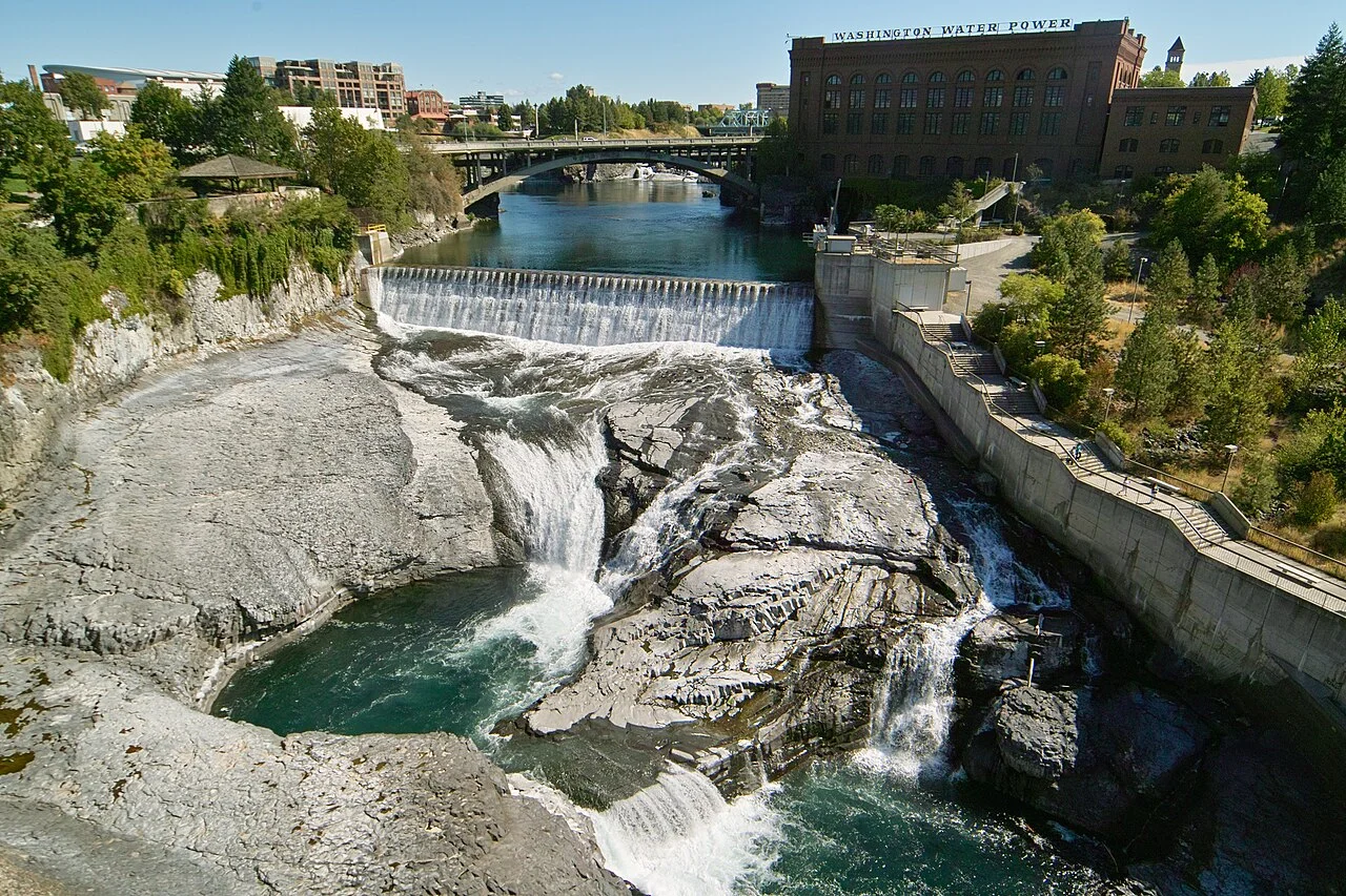

Choose the walking connection using current local instructions. A bridge photograph does not establish that the same pavements, routes or exits are open today. With children, keep any approach to the water under adult supervision and on an accessible route; no photograph beyond railings is recommended. After a short pause, turning towards a meal gives the central loop a natural finish. If weather or transport narrows the day, choosing only one of the falls views still serves the plan. A modest, usable city stay does not require both locations to be completed regardless of circumstances.
West Main: choose a meal from Saranac's actual menu
Saranac Public House publishes 21 West Main Avenue as its address. The current operator page lists 11:00–22:00 on Friday and Saturday and 11:00–21:00 on other days. That gives the first day a concrete central address for a seated meal after the river walk. Choose a service period that fits your real arrival; a late transfer does not guarantee a last-minute table. The business offers a reservation option, but this guide is not a reservation on your behalf. The decision should leave enough time to eat before returning to the room.
Its own menu describes a Blackened Salmon Sandwich with Cajun-seasoned sockeye salmon, sriracha veganaise, tomato, red onion and lettuce on brioche. The Mushroom and Brown Rice Burger is a different choice based on portobello and cremini mushrooms, brown rice and a potato patty. These names make the meal specific instead of directing you vaguely to eat something regional. Check the operator's current menu for price, ingredient needs and the relevant service section. No building visible in a park photograph is labelled as Saranac. The meal evidence comes from the actual operator rather than an unrelated city image.
Cannon Hill: a small pond loop on the second day
The selected Cannon Hill Park photograph shows its pond from the southwest in November 2021. This is a different urban section and scene from the downtown river views. With a separately planned connection towards South Hill on the second morning, the pond can remain a brief neighbourhood pause instead of becoming another large regional excursion. Link transport to your room and luggage arrangements: decide where the bag will remain, then see how much time is genuinely available. A green shape on a map does not prove uninterrupted access or designate a swimming place.
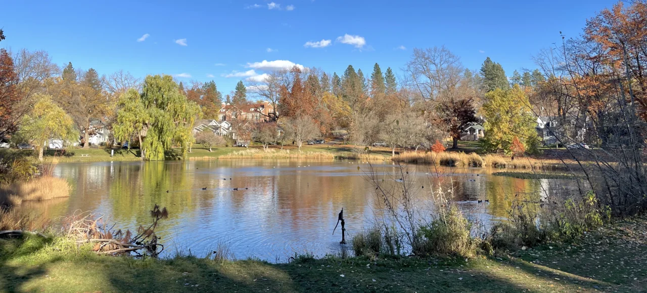

The city's general park rule states that city parks other than Riverfront are closed between 22:00 and 06:00. The Cannon Hill element is therefore a short daytime walk, not a night-camping suggestion or a promise of a staffed facility. Autumn colour in the photograph does not establish today's leaves. A rest, a modest pond-side look and the return connection may be enough for this second morning. There is no assertion that everyone can walk downtown at the same pace or experience the hill with the same ease. The useful difference is the quieter neighbourhood scale, not a compulsory distance target.
Ash Street: see a residential street without making it a performance
The 8 th Avenue and Ash Street photograph is a westward street view from September 2022. Its residential context provides a different scale from the central river and broad park overview. During a neighbourhood walk, remain on the public route rather than extending into private gardens, entrances or living spaces. This is not labelled as a particular film set, open-house tour or paid experience because the source does not provide those claims. Ordinary urban fabric can belong in a city guide without being converted into an invented attraction.
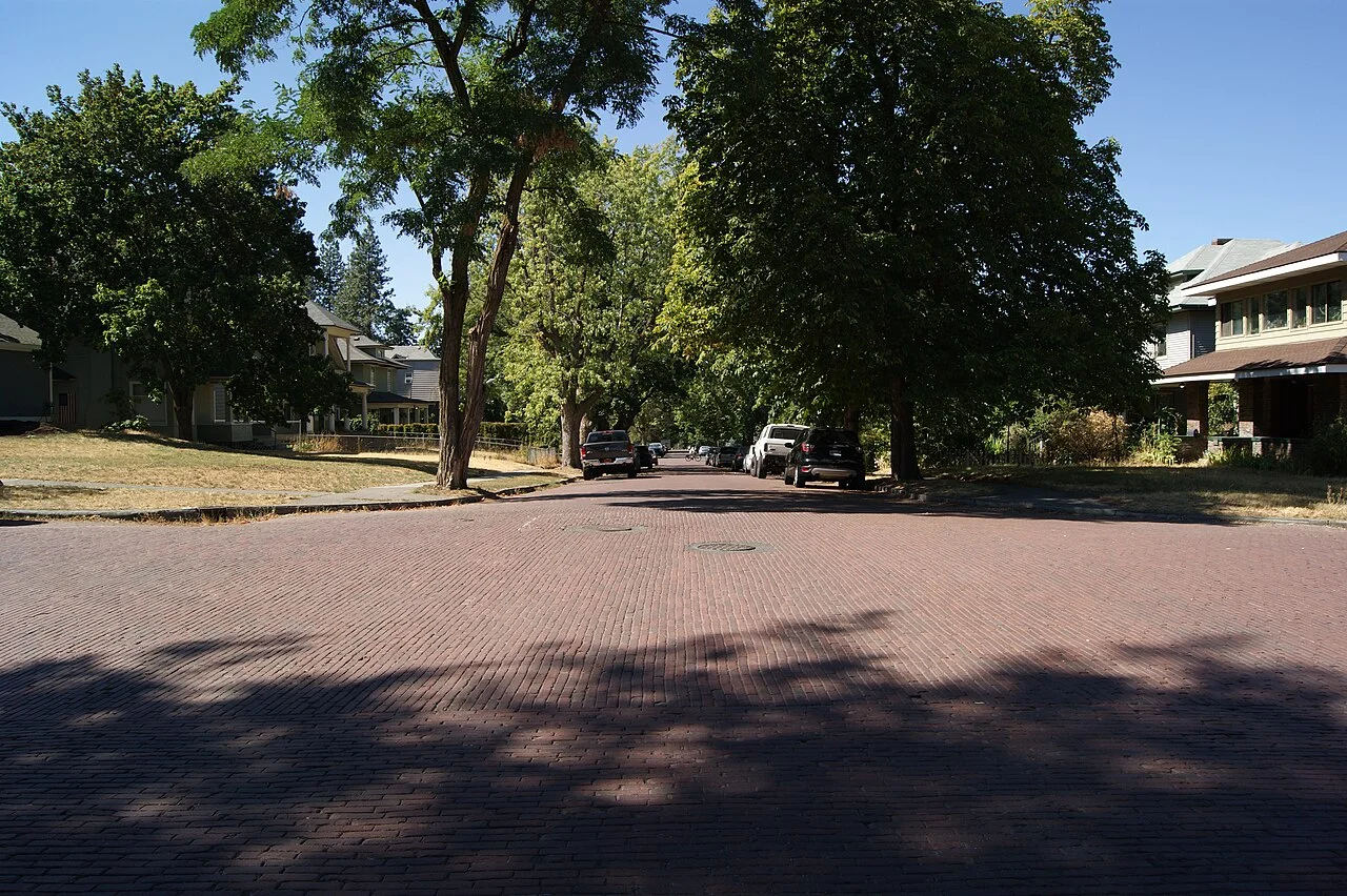

If you include the section on the second day, keep it brief enough not to undermine your return. A pond and an appropriate neighbourhood view can belong to one wider South Hill morning, but no fixed level walking time is fabricated. A park photograph also does not establish that all surrounding streets have the same pavement conditions. The Stork's suggestion separates city scales into two small pieces: centre and river on day one, then a pond and a suitable brief neighbourhood observation. Your actual transport and walking preferences decide whether both second-morning elements fit.
Departure: connect two city pieces to your real ticket
Sequence packing, the pond pause and reaching your transport point as successive tasks on the second morning. Current transit alerts can alter a route, so an old screen should not support a schedule tight enough to miss the final connection. A second central meal or shopping stop belongs only in time remaining after that departure requirement. General city-park operating hours cannot tell you an airport bus departure. Keeping each institution's information within its own subject makes the plan easier to understand and avoids turning an unrelated timetable into a false assurance.
The two days should leave a city reading that distinguishes upper and lower falls, an actual West Main meal and a separate South Hill pond. If you want paid park attractions, select their current operating calendars independently; the basic itinerary does not depend on them. Photograph dates, sources and visible credits remain attached to the images. This is a practical suggestion to adapt to your hours, not a fictional first-person journey presented as completed evidence. It aims to give an overnight a coherent shape rather than mark every possible Spokane address as visited.