
Satara as a city base beneath a fort hill
Satara in Maharashtra offers a way to consider a fort hill and urban life from the same accommodation base. Ajinkyatara's silhouette dominates the broad view, but these two nights are not restricted to climbing a hill and taking a photograph. The Tatilmerkezi Stork builds a smaller city programme around streets, a separate historic church exterior setting and a real regional meal. Three calendar days provide arrival evening, one main urban day with an appropriate fort session, and departure morning. The Mahuli area is a separate nearby option requiring its own vehicle connection, not an automatic tour of the whole district. Kaas flowers, Mahabaleshwar and waterfalls are also different from a city-centre stop. The reader need is to see Satara through a meal and several different surroundings rather than merely using it to leave luggage before other district tours. Older images support names and spatial scale without guaranteeing current weather or admission.
Linking the station and bus stop with a room address
Maharashtra tourism places Satara railway station in the Pune–Miraj line context. This does not establish identical frequencies for every train on the selected travel date. Check the actual station on the ticket together with the room address. Bus arrivals require the same attention to the real drop-off stop and final vehicle connection. A central Satara room can be considered for dinner returns and the urban session around Adalat Wada Road. A property near the highway supplies a different convenience for motorists, not automatically comfortable walking access to fort slopes. Establish late arrival, vehicle approach and luggage storage with the property. Air passengers should connect the airport on the actual ticket with a separate road journey rather than interpreting an approximate duration in official material as an unchanging transfer promise. Learning the final departure point on the first evening reduces urgency during the full urban day. A hill visit with large luggage need not be squeezed into the arrival session.

Reading Ajinkyatara in relation to the lower city
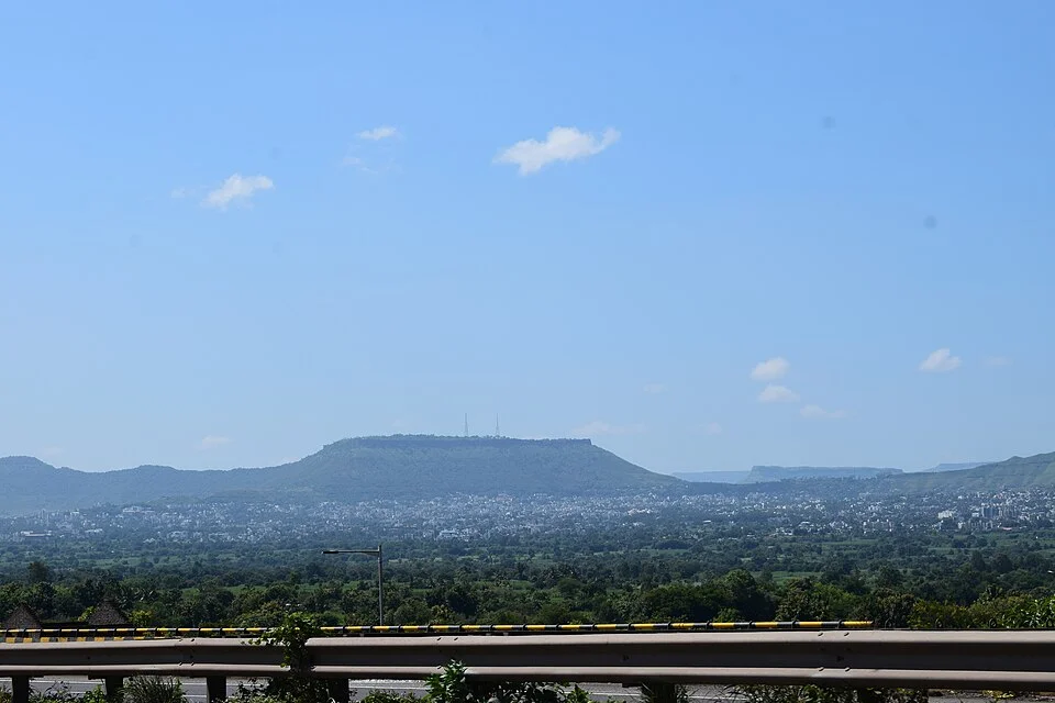
The state introduction describes Ajinkyatara above Satara through broad views and a historic defensive setting. The photographs show two separate relationships: city and hill together from the highway side, and a slope at Ajinkyatara looking toward the lower city. They are not repeated crops of one image. For a fort visit, first establish the open entrance, actual route and return-vehicle arrangements. A short permitted slope session followed by a city return can be more realistic than attempting every surrounding path. Reduce the uphill objective during rain or on slippery ground; viewing the city requires no approach to dangerous stone edges. Different sections of the state page present construction history without the same consistency, so this guide does not establish a single precise year or ruler. Attention remains on the defensive location and relationship with the city. Do not leave return arrangements unresolved for a sunset photograph. Both dated images supply no proof that every current path is open or that visibility remains identical.


Adalat Wada Road and a separate church exterior
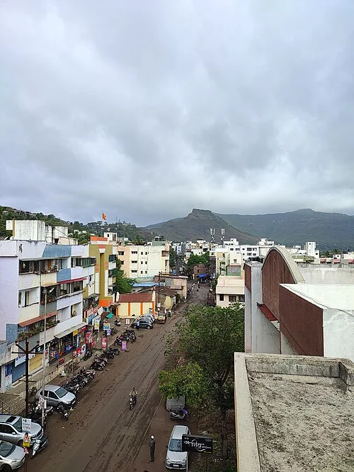
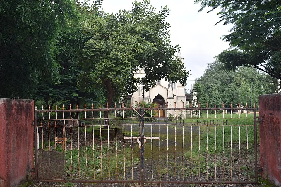
The Adalat Wada Road image records a genuine urban streetscape from above. It is not described as an interior visit to an old palace: the named road and visible buildings and traffic provide sufficient basis for a city session. Establish an appropriate public route from the room address to observe daily movement, giving the settlement seen from the hill a smaller scale. Access to the private high point where the picture was taken is not promised. Our Lady of Health Church supplies a genuinely separate exterior setting behind its fence. Where the public approach permits it, select a brief architectural pause to consider garden, road and facade while respecting worship and closed gates. Surrounding buildings are not all assumed to be tourist attractions. A founding date mentioned in the photograph description is not repeated as independently verified institutional history. These are different street and institution settings, requiring actual distances and crossings rather than being combined into one guaranteed obstacle-free pedestrian route.

A seated lunch of bhakri and pithla
The state's cuisine booklet names bhakri as an unleavened bread prepared from different grain flours, and pithla as a savoury gram-flour dish. Where actually served by a business in Satara, the combination provides a concrete Maharashtra lunch. Bhakri is neither called an invention exclusive to this city nor assumed to use an identical flour in every serving. Discuss the bread's flour and the ingredients in the pithla rather than inferring suitability for individual dietary restrictions from the name. The booklet's named spicy accompaniment thecha can remain optional, without assuming everyone prefers the same heat. A seated meal after returning from the hill gives the street programme a genuine rest interval. The state Satara page also names Kandi Pedha, supplying a separate small sweet option without treating it as an obligatory substitute for lunch. No photograph of a dish prepared in another city is included. No current price or restaurant ranking is invented; business selection depends on actual service that day.
Mahuli as a separate short connection
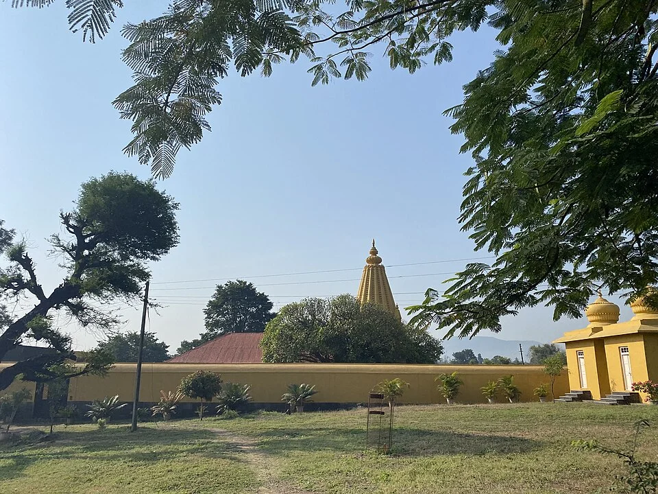
State material identifies Sangam Mahuli and Kshetra Mahuli as two settlements around the confluence of the Venna and Krishna rivers. If choosing this outing during the urban day, calculate the hill return, meal and Mahuli transfer using real time; an existing city session may need replacing. Our photograph shows a temple-yard setting in the Mahuli area rather than a panorama of the river confluence. Water not appearing in the image is a concrete reason to distinguish the settlement's riverside context from what a particular picture actually shows. Establish temple admission and the return vehicle separately. No swimming, boat service or uninterrupted access along the whole bank is promised. Heavy rain can change roads and shoreline conditions, so proximity alone is not enough to organise the connection. For a calmer visit, another night could allow the third day to be allocated here. In the present two-night plan, Mahuli remains an explicitly separate choice rather than a requirement. This preserves the distinction between an urban guide and a district excursion.

Flowers and waterfalls require a real duration decision
Kaas Plateau and Thoseghar waterfall appear under the Satara name but occupy different locations from city streets and the fort setting. A seasonal flower image does not establish identical flowering on a particular travel date. Check current admission, weather and the outward and return connection for this interest; photography areas are not automatically assumed open. Adding another centre such as Mahabaleshwar creates a broader trip than the urban base programme. Two nights in the same room simplify returning for rest and dinner at the end of the main day. The final morning belongs to baggage, check-out and the booked connection rather than a second full city day. Sources were checked on 5 October 2026 and older capture dates remain in photograph credits. The Stork selects Satara through a hill silhouette, a genuine street, a separate institutional setting and a Maharashtra plate, without promising to complete the entire district.