
Twin Falls: plan for the season, not one waterfall photograph
A visit to Twin Falls in Idaho offers more than an attempt to reproduce a single dramatic waterfall image. The Snake River's basalt canyon, Perrine Bridge and Shoshone Falls reveal the landscape in different ways. Southern Idaho Tourism highlights an essential planning point: irrigation diversions can greatly reduce waterfall flow in summer and autumn. Do not book an October trip around the appearance of a spring photograph. Make canyon scenery and a short walk the core of the visit, with a powerful cascade an additional possibility only if current conditions support it.
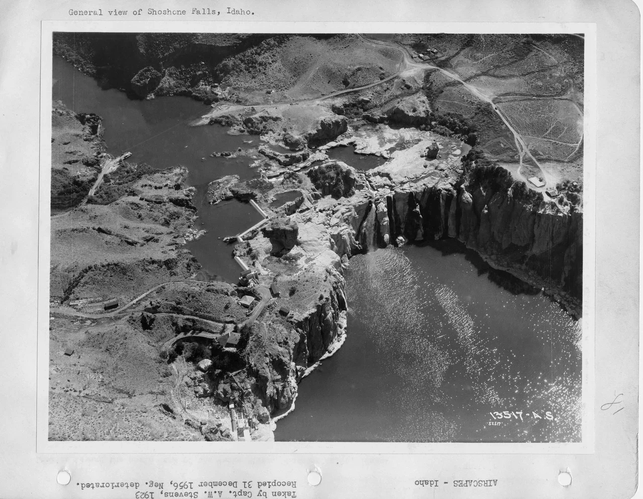
One night and two half-days allow a relaxed introduction. Use arrival day for views around the bridge, then visit Shoshone Falls the following morning. This avoids racing toward the park's sunset closing after a long journey. The guide's images are archives: the bridge and NPS waterfall photographs date to 2007, the black-and-white aerials to 1923, and the sepia photograph to 1867–1868. Historic roads are not current walking directions, and the water in these pictures does not establish today's flow.
A short first-day walk around Perrine Bridge
Perrine Bridge is a useful starting point for understanding the scale of the canyon. The regional tourism page identifies the bridge area as an access point for the developed canyon-rim trail system. After parking appropriately, choose only a section that fits your time and the group's mobility. There is no need to leave public routes to recreate the close viewpoint in a photograph. Pay attention to traffic, other pedestrians and local signs, and keep through-routes clear while stopping for a picture.

The Snake River Canyon Rim Trails page introduces walking possibilities in the area. Joining every line on a map can turn a brief stop into a long walking day. Returning along the same path, or selecting a modest section between two planned points, may be more practical. Include the return in your time estimate. Activities down on the canyon floor should not be automatically attached to a rim walk: the height difference and climb back require their own planning.
Shoshone Falls: use the right address and opening window
The City of Twin Falls visitor page gives the navigation address as 4155 Shoshone Falls Grade Road. The park opens from dawn to dusk, with temporary closures possible during poor road conditions. Year-round opening is therefore not a guarantee of uninterrupted access in every kind of weather. Check municipal notices and the linked live camera before leaving. If the camera is unavailable, do not infer current flow from an old screenshot; keep the outing focused on the canyon and viewpoints.

The published seasonal vehicle charge is five dollars per car from March 1 through autumn. Since the page does not specify a precise autumn end date, include that cost in an October budget and check the current gate arrangement. Overnight camping and parking are not offered. Return to your accommodation after the day visit rather than building a night in the car into this itinerary. Allow room for stops and parking instead of reducing the viewpoint to a rushed glance because a restaurant booking is approaching.
Viewing access, low flow and historical photographs
The municipality places the nearest parking spot about seventy-five feet from the main viewing platform and identifies accessible viewpoints that do not require stairs. That does not mean every surrounding trail has the same difficulty. With someone whose mobility is limited, plan a short viewing visit separately from a longer walk; availability of suitable parking also matters. Discuss the return, rest breaks and facilities beforehand. Families often benefit more from a comfortable shared pace than from trying to cover every viewpoint.

Low autumn water does not mean the falls are controlled by a simple on-off switch. The city explains the roles of snowpack, irrigation and reservoir management. Historical aerial photographs help show the relationship between the canyon and water infrastructure in an earlier period, but are not substitutes for a current park map. If you do not encounter the torrent shown in the sepia image, the whole visit has not been wasted: compare the rock shelves, river direction and canyon depth visible from the viewpoint. Reading an image's date is part of understanding what it can tell you.
A Hilton Garden Inn stay and a realistic transport plan
Hilton Garden Inn Twin Falls is at 1741 Harrison Street North. The official information gives check-in at 4 pm and check-out at 11 am. Parking is complimentary, while breakfast is available for a fee; do not assume that the room automatically includes it. An airport shuttle is unavailable, so organise your transfer separately if flying. Compare the full cost, cancellation terms and intended departure time when choosing a rate. If arriving early, ask about leaving bags rather than assuming a room will already be ready.

The accommodation, bridge area and waterfall park are separate stops. A car can make this brief itinerary easier to arrange. Without one, secure the return journey from the park in advance. A distance shown on a phone map does not establish a direct pedestrian connection between every point around the canyon. If the same morning contains a long rim walk, the falls visit and hotel check-out, simplify the plan. Keeping a rest buffer before a flight or substantial onward drive can be more valuable than adding another viewpoint.
An actual main course at Elevation 486
The dinner menu at Elevation 486, 195 River Vista Place, includes Idaho Ruby Red Trout. Its dish description specifies a boneless fillet, pan-broiled and prepared with smoked red-pepper butter. This is an identified main course from the restaurant's information, not a claim of personal tasting. Confirm accompaniments, allergens and that day's availability when booking. Different price displays appear across the menu and item screens, so this guide does not promise a fixed charge; ask the business for the final price.
Check service hours for the date you choose. Online ordering being unavailable does not necessarily mean the dining room is closed. Avoid setting dinner so close to the waterfall park's closing that the journey becomes rushed. Leaving time to wash, change or return to the hotel makes the meal a more enjoyable part of the day. Practical details were checked against primary sources on 18 October 2026. Revisit official pages on the travel morning because roads, weather, water flow and business arrangements can change.