
Chitradurga and the relationship between rock, defence and water
A Chitradurga city visit begins by reading defensive layers built among large granite formations. In this inland Karnataka town, the Tatilmerkezi Stork follows the different needs represented by walls, passages, a pond and a gunpowder-grinding installation instead of making a single high viewpoint the entire objective. The fort is more than a photographic background: it offers a way to consider protection and daily life together. Two nights and three calendar days provide arrival, one main fort-and-city-meal day and departure. This calculation does not create two complete walking days. Paths among rocks and structures surrounding water are not repetitions of the same scene. Examining a small architectural detail carefully may be more meaningful than racing to finish the whole complex. Adjust the city programme to physical capacity, with steps, sun and the return distance treated as real factors. A distant district dam or another pilgrimage stop is not automatically included in the day.
An urban base and an arrival separate from the walk
Choose the actual arrival point for the Chitradurga transport reservation together with the room address. A bus drop-off stop, or the station on a rail ticket, needs a real final vehicle connection. Central accommodation may simplify the return for lunch and rest after a fort session. Roadside accommodation can prioritise departure by car, but does not automatically provide comfortable pedestrian access to the monument. Arrival evening can supply baggage drop-off, drinking-water preparation and arrangements for the following day's return. A late arrival need not include a race to reach the fort. Discuss late check-in, morning luggage storage and the actual entrance address with the property. No unverified service frequency, fare or identical travel duration is supplied. Before beginning the main walk, establish the open entrance and admission arrangements for that date rather than interpreting the fort boundary on a map as a freely accessible walking area.
A selected route through defensive layers
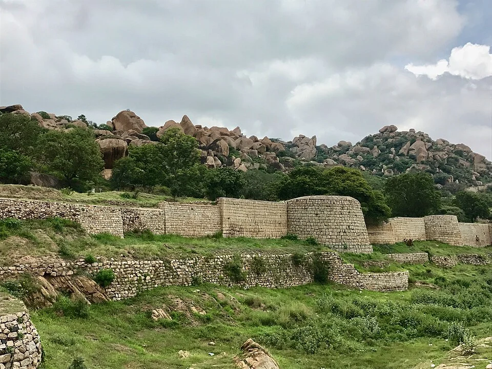
State tourism introduces the fort through its seven-circle defensive context. This should not become an obligation to climb every separate wall. An initial broad look can concentrate on a rounded bastion, the wall extending from it and the natural rocks behind. The combination of constructed passages and rocky ground distinguishes this fort from a defensive building on a flat site. Vegetation visible in the photograph belongs to its 2017 capture conditions, not a promise of identical seasonal appearance. Choose a shorter turning point along the permitted route to retain energy for returning. Where steps or uneven ground become difficult, stay with a lower section instead of adding another summit. A guide who explains the relationship between successive walls can be more useful than simply collecting monument names. Present closures and maintenance determine the real limits of the walk. The historical existence of concealed passages does not show that every passage can be entered today.

The gunpowder-grinding stone and the work of defence
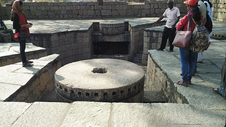
A stone mill belonging to the gunpowder-grinding installation supplies a different function from the surrounding walls. The genuine source photograph shows its circular stone arrangement and low boundaries. It is not described as an operating demonstration machine or a device for visitors to use. This is a separate opportunity to consider defence as material preparation as well as keeping attackers outside. Read any accessible information panel locally and examine the installation without touching or climbing it. Moving a component is not a sightseeing objective. A short look from the side may be sufficient in a crowded setting; places occupied by people in an older photograph are not necessarily open in the same way today. Sequence the stop according to the permitted route rather than lengthening the wall session unnecessarily. Preparing gunpowder has a function different from the water pond's relationship with life inside the fort. These allow genuinely different uses within one complex to be considered.

Gopalaswamy pond and the fort water setting
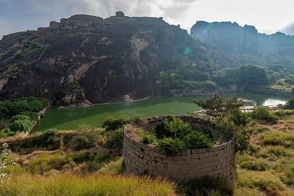
The Gopalaswamy pond photograph combines rocks, a water surface and defensive surroundings in a separate location scene. State tourism describes reservoirs within the fort; their relationship with the settlement provides a useful short water-focused session. The visible water level belongs to the 2020 photograph. It supports no promise of constant fullness, safe swimming or drinking-water quality. Follow an appropriate path to observe the surrounding structure and the extent of the natural rocks, slowing the rhythm of the main walk. Choose a distant look where banks are unprotected or surfaces slippery. A pond pause does not replace preparing actual drinking water: water carried for the day and a shaded rest are separate needs. In hot conditions, returning to a seated city lunch can be more comfortable than adding another rocky ascent. No boat service, swimming session or paid activity is invented where the source photograph and location account do not establish one.

Obavvana Kindi and a carved entrance detail
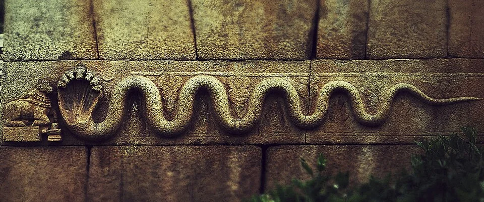
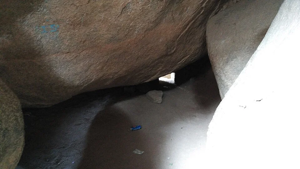
The Onake Obavva narrative is associated with a narrow opening in the fort wall. The state source presents it as part of local heroic memory, and this guide treats it as a historical narrative rather than an event re-enacted during every visit. The photograph shows a small opening beneath a rock. It does not mean visitors must pass through it or that it is a safe shortcut. A look from the permitted side is enough to consider the scale of the space. An ancient carved serpent detail at an entrance is a different image from the narrow opening, not another crop of it. Examining its place within stone architecture prevents the fort from being reduced only to a battle story. The picture dates from 2012 and does not establish that surface conditions remain identical. Leave without obstructing a queue or other people's movement in a narrow crowded section. Neither detail implies compulsory climbing or a scheduled performance.

A real city lunch with chitranna
The state cuisine booklet names chitranna, a lemon-rice preparation, among Karnataka dishes. If actually served by a business reached after the fort walk, it supplies a concrete regional lunch option. It is not called an invention exclusive to Chitradurga or a product prepared identically in every restaurant. An actual available vegetable or pulse preparation can complete the meal. The same booklet identifies bisibelebath, combining rice and lentils, as another option; ordering both is not required. Discuss spices and individual ingredient restrictions for the plate being served. The lunch interval includes sitting and resting rather than merely eating a snack while rushing toward another rock. This meal is not tied to an imagined cafe inside the fort. No current price or restaurant ranking is invented. Arrange the return using the real room address so that a decision about another exposed sightseeing session can be made comfortably after a genuine rest.
Changing the programme for Chandravalli or a dam
If Chandravalli and the Ankali surroundings interest you, treat them as another session rather than a mandatory extension of the fort walk. State tourism describes the archaeological setting and nearby lake; real admission and lighting conditions must establish any cave-interior visit. Vani Vilas Sagar is not the same thing as a pond in the city centre. It is a separate dam setting requiring district transport. The state introduction places it approximately sixty kilometres from Chitradurga, a distance that establishes neither fixed driving time nor an automatic transfer. A second full sightseeing day requires a genuine duration change, such as keeping another night and using day three for a visit instead of departure. In the present two-night plan, the last morning belongs to luggage and the return journey. Sources were checked on 5 October 2026 and older photograph dates remain in the credits. The Stork uses one main day to distinguish stone defence, material preparation, water and an actual urban meal.